Giter Club home page Giter Club logo

knime-geospatial-extension's People

Contributors

bernd-wiswedel avatar koettert avatar sturmkev avatar urbangiser avatar wybert avatar

Stargazers

 avatar  avatar  avatar  avatar  avatar  avatar  avatar  avatar  avatar  avatar  avatar  avatar  avatar  avatar  avatar  avatar  avatar  avatar  avatar

Watchers

 avatar  avatar  avatar

knime-geospatial-extension's Issues

Geospatial View and Spatial Heatmap fail if table contains special characters

It seems that the Geospatial View and Spatial Heatmap do not escape special characters when creating the GeoJSON stringe e.g. the following input string creates an exception I guess because of the {} brakets:
I didn’t want to do it. but I did it anyway. I looked at the Town Halls. {{{what a mess}}} they are so different. #Biden is a gentle caterpillar while #Trump is a rabid fox 🥺 #TownHalls #trustYourInstinct #election2020 #holdontight #bumpyride

Example workflow can be found here: https://hub.knime.com/tobias.koetter/spaces/Geospatial/latest/bugs/ViewsWithUnescapedStringProblem~m87FqNLk_gM68CYx

US2020 Tiger Map node produces corrupt output table for specific queries

Depending on the query the output table can’t be viewed (it gets stuck at “Loading port content…”. In addition, when wanting to reset the node, the following error is shown: Error when attempting to close open closeable.WARN ResetAction Reset not allowed

Node config:

  • State FIPS: 01
  • County FIPS: 01 (same as State FIPS because I want all counties of state 01)
  • TIGER/line data type: county20

The node execute successfully but I can’t use it for further processing (tried Joiner node and Geospatial View node)

See example workflow here: https://hub.knime.com/tobias.koetter/spaces/Geospatial/latest/bugs/Faulty%20exection%20Tiger%20Map%20node~p65jSa5GEUA_THX_

Deselecting columns from configuration fields inside the <geospatial view> node (or others) not possible

When I configure a <geospatial view> node and want to use one of my columns for the 'Marker Color Column' field. If my selected column holds too little values the preview fails, which is ok. So far, I didn't find a way to deselect the column from that field, so that I basically select no column for the 'Marker Color Column'. Could we add an empty field for the drop down selection of the columns or any way to deselect the column again?
image
image
image
image

<buffer> does not pre-select the geometry column

When adding a <buffer> node to the workflow and connecting it to a table with a geometry column, it doesn't pre-select the geometry column (even though there is only one) and hence, the node is in an unconfigured state.

WARNING at start of <geospatial view> node configuration seems unnecessary

When configuring the <geospatial view> node for the first time, the 'geometry' column is pre-selected. At the bottom of the (pre-)view we prompt a warning that this column is preset.
It seems to me, that this might be counter-intuitive, since the orange color might indicate that something is off.
I would think that we do not need to prompt this warning, since the user sees that the geometry column is selected at the top right. But this is just an idea.
image

Improve node description of Spatial Join node

The Spatial Join node right now uses HTML tags (e.g. Join mode section) in the node description which are not correct rendered in KNIME. Instead it should use markdown for lists etc.

Add more visualization options to Spatial Heatmap

Add visualization settings from the Geospatial View to the Heatmap view e.g. color and legend settings. Show the heatmap settings (weight, opacity, zoom, radius, blur) as first group in the dialog followed by the visualization settings from the Geospatial View.

Create a new settings class for the general options (base map, stroke, marker size, tooltip, popup) in the Geospatial View node to reuse it also in the Heatmap View along with the other existing settings groups e.g. Coloring Settings and Legend Settings.

US2020 Tiger Map node fails for some requests e.g. New York (36) or District of Columbia (11)

Getting errors when trying to execute US2020 TIGER Map node. Two types of error messages depending on what I want to do:

Execute failed: HTTP Error 404: Not Found or

Execute failed: An error occurred while calling o15.reportBatchWritte

Node works fine for some states (e.g., configuring the node to extract all tract20 for Florida or Maryland works fine, but fails when trying for New York (36) or District of Columbia (11). Also tried different data type like tract, block group, etc., node just fails.

I checked archive (Index of /geo/tiger/TIGER2020PL/STATE ) and was able to download the zipped archive for New York manually.

GeoJSON to Geometry fails

The GeoJSON to Geometry node fails with
File "C:\DEV\GIT\EXTERNAL\knime-geospatial-extension\knime_extension\src\nodes\conversion.py", line 254, in execute raise RuntimeError( RuntimeError: Error converting 'GeoJSON' column to geometry: Unknown column geometry

Fix GeoJSON to Geometry node description

Node description states that the field “geojson column” expects a GeoJSON column to convert. However, it does not recognize any JSON column but only STRING columns.

The input port description lacks in detail, as it states “input table to extract the geometry column from”. Actually, the geometry column is what we want to generate, so why should our input table have it already?

The embedded “From GeoJSON” link actually points to the from_wkt method.

How to read GADM geopackage files with the

I tried to read a GADM geopackage file with the GeoPackage Reader node but failed. With different error messages. What do I need to specify as the Input layer name for reading (Has also a typo).

Additional information for node description might be helpful on “US2020 Tiger Map” node.

As one needs to type in FIPS for state (and county) it might be helpful to include this additional link to the node description to let unexperienced users understand the states/counties and their corresponding FIPS. As one needs to type in FIPS for state (and county) it might be helpful to include this additional link to the node description to let unexperienced users understand the states/counties and their corresponding FIPS.

In addition include some of the most common counties (e.g. New York) as an example into the node description.

Support * in US202 Tiger Map node

With the 2020 US Census Data node it is possible to enter “*” to select all states/counties. Would be nice to have the same option for the Tiger Map node

Improve Kepler.gl Geoview node description

The node actually takes all column information which is included inside the table. Therefore, it might be better to let the user know, if one wants to limit the amount of information which is passed onto the node (also stating what information is necessary).

Improve node description of Spatial Modeling nodes

All the spatial modeling nodes do not have a general description about what they are doing. Ideally each node has a short description with link(s) to other resources describing the methods in detail.

Geocoding support

As a user I want to get the geo coordinates of an address. To do so I want to use a free provider such as OSM but also commercial once such as here.com or Google.
The input of the node would be a table with the address information and the node would append a new column to each row with the geo coordinates of the corresponding address.

Move Dataverse nodes to own extension

Move the dataverse nodes to their own extension to make them usable also for none Geospatial users.

Do not forget to remove the dataverse dependency from the geospatial_env.yml file

Kepler.gl Geoview, Geospatial View and Geospatial View static do not work with geometric columns that are not named "geometry"

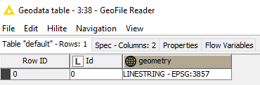
To reproduce create a KNIME table with a Geo column with name column1. Select this column to visualize it in the Kepler.gl view node and you will get the following exception:
WARN Kepler.gl Geoview 3:117 Traceback (most recent call last): File "C:\KNIME\NIGHTLY\knime_nightly\plugins\org.knime.python3.nodes_4.7.0.v202210281512\src\main\python\knime_node_backend.py", line 470, in execute outputs = self._node.execute(exec_context, *inputs) File "C:\DEV\GIT\EXTERNAL\knime-geospatial-extension\knime_extension\src\nodes\visualize.py", line 865, in execute map_1.add_data(data=gdf.copy(), name="state") File "C:\Users\Tobias\.conda\envs\geospatial_env\lib\site-packages\keplergl\keplergl.py", line 140, in add_data normalized = _normalize_data(data) File "C:\Users\Tobias\.conda\envs\geospatial_env\lib\site-packages\keplergl\keplergl.py", line 50, in _normalize_data return _gdf_to_dict(data) if isinstance(data, geopandas.GeoDataFrame) else _df_to_dict(data) File "C:\Users\Tobias\.conda\envs\geospatial_env\lib\site-packages\keplergl\keplergl.py", line 44, in _gdf_to_dict df[name] = df.geometry.apply(lambda x: shapely.wkt.dumps(x)) File "C:\Users\Tobias\.conda\envs\geospatial_env\lib\site-packages\pandas\core\generic.py", line 5907, in __getattr__ return object.__getattribute__(self, name) AttributeError: 'DataFrame' object has no attribute 'geometry'

US Census and Tiger maps node with links in option description

The new node dialogs have a little icon next to each dialog option. To make it easier for people to find the right MIPS etc numbers it would be great if we could add a link to a lookup page to the corresponding dialog option so that the link is shown directly in the node dialog when clicking on the question mark of the option.

Reverse geocoding support

As a user I want to get the address of a geo coordinate. To do so I want to use a free provider such as OSM but also commercial once such as here.com or Google.
The input of the node would be a table with geo coordinate (point) and the node would append new columns to each row with the corresponding address.
This was requested during the summit and in the KNIME forum.

Geospatial View Static node throws exception if "Marker color column" is not selected

To reproduce use an input table with a single Geo column. Execute the node as it is predefined (e.g. Geometry column is the input column and Marker color column is empty). Do not select None in the Marker column select box. This results in the following error:
WARN Geospatial View Static 3:119 Traceback (most recent call last): File "C:\KNIME\NIGHTLY\knime_nightly\plugins\org.knime.python3.nodes_4.7.0.v202210281512\src\main\python\knime_node_backend.py", line 470, in execute outputs = self._node.execute(exec_context, *inputs) File "C:\DEV\GIT\EXTERNAL\knime-geospatial-extension\knime_extension\src\nodes\visualize.py", line 721, in execute self.legend_caption = self.color_col File "C:\KNIME\NIGHTLY\knime_nightly\plugins\org.knime.python3.nodes_4.7.0.v202210281512\src\main\python\knime_parameter.py", line 426, in __set__ self._validate(value) File "C:\KNIME\NIGHTLY\knime_nightly\plugins\org.knime.python3.nodes_4.7.0.v202210281512\src\main\python\knime_parameter.py", line 435, in _validate self._validator(value) File "C:\KNIME\NIGHTLY\knime_nightly\plugins\org.knime.python3.nodes_4.7.0.v202210281512\src\main\python\knime_parameter.py", line 652, in default_validator raise TypeError( TypeError: None is of type <class 'NoneType'>, but should be of type string.

IP location support

As a user I want to get the geo coordinates of an IP address. To do so I want to use a free provider such as OSM but also commercial once such as here.com or Google.
The input of the node would be a table with the IP address and the node would append a new column to each row with the geo coordinates of the corresponding address.

Recommend Projects

  • React photo React

    A declarative, efficient, and flexible JavaScript library for building user interfaces.

  • Vue.js photo Vue.js

    🖖 Vue.js is a progressive, incrementally-adoptable JavaScript framework for building UI on the web.

  • Typescript photo Typescript

    TypeScript is a superset of JavaScript that compiles to clean JavaScript output.

  • TensorFlow photo TensorFlow

    An Open Source Machine Learning Framework for Everyone

  • Django photo Django

    The Web framework for perfectionists with deadlines.

  • D3 photo D3

    Bring data to life with SVG, Canvas and HTML. 📊📈🎉

Recommend Topics

  • javascript

    JavaScript (JS) is a lightweight interpreted programming language with first-class functions.

  • web

    Some thing interesting about web. New door for the world.

  • server

    A server is a program made to process requests and deliver data to clients.

  • Machine learning

    Machine learning is a way of modeling and interpreting data that allows a piece of software to respond intelligently.

  • Game

    Some thing interesting about game, make everyone happy.

Recommend Org

  • Facebook photo Facebook

    We are working to build community through open source technology. NB: members must have two-factor auth.

  • Microsoft photo Microsoft

    Open source projects and samples from Microsoft.

  • Google photo Google

    Google ❤️ Open Source for everyone.

  • D3 photo D3

    Data-Driven Documents codes.