openmaptiles / maptiler-basic-gl-style Goto Github PK
View Code? Open in Web Editor NEWBasic GL Style using OpenMapTiles
Home Page: https://www.maptiler.com/maps/#basic//vector/1.53/3.2/0
License: Other
Basic GL Style using OpenMapTiles
Home Page: https://www.maptiler.com/maps/#basic//vector/1.53/3.2/0
License: Other
Where are the icons and glyphs?

Example Hồ Chí Minh = Ho Chi Minh ố ồ
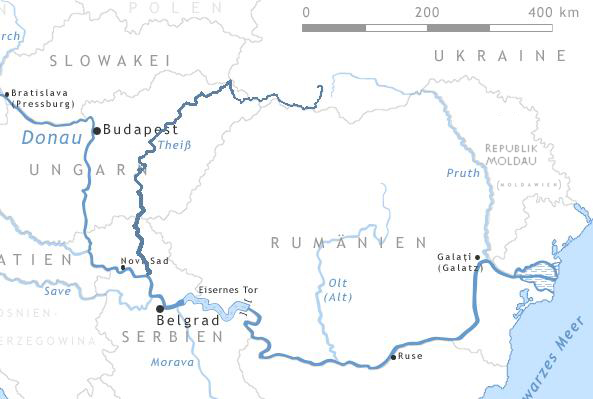
In the following picture :

In the following picture :

the Tisza river ( Near Szeged ) is only show in the z12
Missing from z8-z11
https://openmaptiles.github.io/klokantech-basic-gl-style/#11.32/46.2154/20.2069


( but I know - it is not so easy ... )
https://en.wikipedia.org/wiki/Tisza#/media/File:Thiz_river.jpg

Could you make a new release (https://github.com/openmaptiles/klokantech-basic-gl-style/releases) please which includes the latest changes (e142f83)?
The tag tunnel=culvert is not supported and waterway appear as standard waterway. which is ugly for culvert streams or rivers way in city.
Hi!
As asked in maplibre-gl-js discussions forum: maplibre/maplibre-gl-js#4417 , in StackOverflow : https://stackoverflow.com/questions/78759874/maplibre-issue-with-style-json-and-tiles-vector-url and in GIS StackExchange : https://gis.stackexchange.com/questions/483886/maplibre-issue-with-style-json-and-tiles-vector-declarations-in-html I'm having an issue in visualizing, locally, the map
I want to use this TileServer: https://tileserver.linuxbabe.com/ with MapLibre
The style.json should be this: https://tileserver.linuxbabe.com/styles/basic-preview/style.json and, based on https://tileserver.linuxbabe.com/data/v3.json

the tiles vector URL should be this: https://tileserver.linuxbabe.com/data/v3/{z}/{x}/{y}.pbf
But If I put those two URLs in their fields in the HTML, I do not get any output :

This is the complete map.html file :
<!DOCTYPE html>
<html>
    <head>
     <meta charset="utf-8">
     <title>Vector Tile Map with MapLibre</title>
     <meta name="viewport" content="initial-scale=1,maximum-scale=1,user-scalable=no">
     <script src='https://unpkg.com/maplibre-gl@latest/dist/maplibre-gl.js'></script>
    <link href='https://unpkg.com/maplibre-gl@latest/dist/maplibre-gl.css' rel='stylesheet' />
     <style>
        body { margin: 0; padding: 0; }
        #map { position: absolute; top: 0; bottom: 0; width: 100%; }
     </style>
   </head>
   <body>
        <div id="map"></div>
        <script>
            var map = new maplibregl.Map({
                container: 'map',
                style:
                    'https://tileserver.linuxbabe.com/styles
/basic-preview/style.json',
                    zoom: 5.43,
                    center: [-3.9, 54.5]
            });


            map.on('load', function () {
              // Add a new vector tile source with ID 'linuxbabe'.
              map.addSource('linuxbabe', {
                     'type': 'vector',
                     'tiles': [
                          'https://tileserver.linuxbabe.com/data/v3/{z}/{x}/{y}.pbf'
                      ],
                      'minzoom': 6,
                      'maxzoom': 14
                });
                map.addLayer(
                   {
                        'id': 'default', // Layer ID
                        'type': 'line',
                        'source': 'linuxbabe', // ID of the tile source created above
                           // Source has several layers. We visualize the one with name 'sequence'.
                        'source-layer': 'sequence',
                        'layout': {
                                  'line-cap': 'round',
                                  'line-join': 'round'
                         },
                        'paint': {
                                   'line-opacity': 0.6,
                                   'line-color': 'rgb(53, 175, 109)',
                                   'line-width': 2
                         }
                  },
               );
            });

            map.addControl(new maplibregl.NavigationControl());

            //set max zoom level (0-24)
            map.setMaxZoom(19);
    </script>
    </body>
</html>
What am I missing and / or am I doing wrong?
I've put the code in:
jsfiddle: https://jsfiddle.net/RaphyCollab/oq19abd4/2/
jsbin repo : https://jsbin.com/dekujuz/edit?html,output
github gist : https://gist.github.com/raphael10-collab/2c1676a37c2193c79b110ecdfe33215d
OS: Ubuntu 23.10
Please see the appearance of the streets while zooming for example around Washington, DC in:
New KlokanTech Basic Style:
https://openmaptiles.github.io/klokantech-basic-gl-style/#11.89/38.8924/-77.0166
Old KlokanTech Basic Style:
http://klokantech.tilehosting.com/styles/basic/?key=tXme5cuqgrCqdPoZHqyn#9.75/38.7970/-76.9164
Or compare with other existing maps, please, such as
https://www.google.com/maps/place/Washington,+DC,+USA/@38.8660799,-77.0858514,11.54z/data=!4m5!3m4!1s0x89b7c6de5af6e45b:0xc2524522d4885d2a!8m2!3d38.9071923!4d-77.0368707?hl=en
On zoom level 5, detailed region borders appears in many countries (e.g. Czech Republic, France, ...).
On zoom level 6, they disappear and instead superior regions boundaries appear (which are less detailed).
An example is visible on this map if you zoom in - instead of more details, you see less.
Please see the appearance of the green areas for example around Washington, DC in:
New KlokanTech Basic Style:
https://openmaptiles.github.io/klokantech-basic-gl-style/#11.89/38.8924/-77.0166
Old KlokanTech Basic Style:
http://klokantech.tilehosting.com/styles/basic/?key=tXme5cuqgrCqdPoZHqyn#9.75/38.7970/-76.9164
Or compare with other existing maps, please, such as
https://www.google.com/maps/place/Washington,+DC,+USA/@38.8660799,-77.0858514,11.54z/data=!4m5!3m4!1s0x89b7c6de5af6e45b:0xc2524522d4885d2a!8m2!3d38.9071923!4d-77.0368707?hl=en
Basic does not need one-way and sprites
In the style are different colors for rivers and water areas. Rivers are lighter. On lakes and large rivers is a visible river line. Is it possible to assign the same color to a river? Make it sense? Se screenshot:

Hi,
I noticed that the public map viewer on maptiler.com uses a basic-v2 style. Is this style also released somewhere under a similar license?
Hello,
I installed maptiler-server via maptiler-server-3.0.1-linux.deb and successfully installed the package maps with maptiler-server-map-styles-3.12. Yet when I try to install directly this github master version maptiler-basic-gl-style, the server cannot load it and display Warning with the following message for the style.json file related to https://api.maptiler.com/tiles/v3/tiles.json forbidden call. I added my cloud API key but still can't fix the issue. Could you help ? Thanks.
unexpected format. Reason: StyleJsonWithStructuredRefs does not satisfy required schema: referencing api.maptiler.com in https://api.maptiler.com/tiles/v3/tiles.json?key={key} is forbidden; referencing api.maptiler.com in https://api.maptiler.com/fonts/{fontstack}/{range}.pbf?key={key} is forbidden
My tiles are all from the USA.mbtiles subset. The current problem I'm seeing is the apparently old (complained-about in 2015) "Unimplemented type: 3" It can find .pbfs at zoom 2 that it can't find at, e.g., zoom 14. At z2, my GETs appear to succeed: It fetches
No map fragments appear, even though it only complains about some of the .pbfs.
Does this style use sprites? They were referenced in the style.json.
A declarative, efficient, and flexible JavaScript library for building user interfaces.
🖖 Vue.js is a progressive, incrementally-adoptable JavaScript framework for building UI on the web.
TypeScript is a superset of JavaScript that compiles to clean JavaScript output.
An Open Source Machine Learning Framework for Everyone
The Web framework for perfectionists with deadlines.
A PHP framework for web artisans
Bring data to life with SVG, Canvas and HTML. 📊📈🎉
JavaScript (JS) is a lightweight interpreted programming language with first-class functions.
Some thing interesting about web. New door for the world.
A server is a program made to process requests and deliver data to clients.
Machine learning is a way of modeling and interpreting data that allows a piece of software to respond intelligently.
Some thing interesting about visualization, use data art
Some thing interesting about game, make everyone happy.
We are working to build community through open source technology. NB: members must have two-factor auth.
Open source projects and samples from Microsoft.
Google ❤️ Open Source for everyone.
Alibaba Open Source for everyone
Data-Driven Documents codes.
China tencent open source team.