As part of the Summer Team Enterprise Project, run by the university, I have been working with a group to look into female historians in St Andrews. Working through a series of research questions posed, we have been looking through records in the archives and available sources, such as the University Calendars, to try and get a clearer picture of the history of female history students and staff within the university. As part of this, one of the blog posts I have been developing (blog found here - https://women-historians.wp.st-andrews.ac.uk/) was looking into the geography of the undergraduate students. We collected all the data from the University Catalogues from 1905-1995, making note of the registered home town of the female history graduates if they were given for the current year. The code in this repository was used to create some gifs and images for the accompanying blog post (https://women-historians.wp.st-andrews.ac.uk/2021/07/24/hometown-and-gown-mapping-the-origins-of-female-historian-undergrads/).
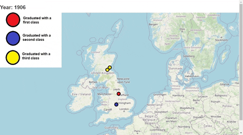
The following shows the geography for the UK based students:
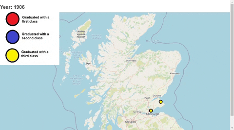
The next graph demonstrates what was happening with the home towns on a more local level:
To make these maps, I used the folium library in Python, with Selenium and a chrome driver to create the gifs at the end.
It has been really fun to once again combine some map work to provide more historical insights, this project has a lot more potential, but we were only given a set 5 weeks to work on it. If I had more time, it would be really fun to explore some of the overall trends in undergraduates' locations and look through more records (such as the overall graduation archive material) to get more extensive data to make the maps with.


